Osa Peninsula · South Pacific Costa Rica

Corcovado National Park

A guide written by the people who work inside it

National Geographic called this the most biologically intense place on Earth. On the ground that means something simpler: there is no road in, no fence, no artificial ingredients. You cross the Pacific by boat, walk through hours of forest that has never been cut, and the beach appears. What the forest shows you after that is the forest's decision, not ours.

A Baird's tapir and its calf walking along a riverbank inside Corcovado National Park, Costa Rica
Baird's tapir with calf — the largest land mammal in tropical America, and a relative of the rhino.

Field record

Protected area
42,000 haRoughly a third of the Osa Peninsula
Protected since
1975Fifty years of forest regenerating
Daily visitor cap
120 peopleA hard limit. Permits sell out months ahead
Certified guide
RequiredYou cannot legally enter the park alone
Road access
NoneBoat or on foot. That is the whole list
Birds recorded, Osa
450+More than half of every species in Costa Rica
David Villanueva, naturalist guide and co-founder of Sukia Travel

What Corcovado is

Why Corcovado is the best national park in Costa Rica

Corcovado protects 42,570 hectares of land and 5,375 of ocean on the Osa Peninsula, in the far southwest of the country. It was declared in 1975 and covers about a third of the peninsula. National Geographic called it the most biologically intense place on Earth, and the phrase has followed it ever since.

Costa Rica has more than twenty national parks and several are excellent. So the useful question is not whether this one is famous. It is what it does that the others cannot.

01

Density you can measure

The Osa Peninsula holds an estimated 2.5% of the planet's biodiversity. On one trail at Sirena, researchers counted more than 140 tree species inside a hundred square metres.

02

It was never tamed

No road in, no boardwalk, and you cannot enter alone: a certified guide is required and daily numbers are capped. Inconvenient by design, which is why the forest still behaves like one.

03

Several ecosystems, one park

Primary and secondary rainforest, rivers, waterfalls, beaches, mangrove nearby and protected ocean offshore. Most parks give you one habitat. Here you cross several in a day.

Corcovado or Manuel Antonio?

Manuel Antonio is beautiful, easy to reach and a good first encounter with Costa Rican wildlife. It is also small, bordered by a town and among the most visited parks in the country. Corcovado asks more of you and returns wilderness instead of convenience. One day and limited mobility, go to Manuel Antonio. Came for the real thing, come here.

Corcovado or Tortuguero?

Different animals, different medium. Tortuguero is a Caribbean canal system, known for nesting turtles and seen almost entirely by boat. Corcovado is Pacific rainforest walked on foot, with the largest concentration of land mammals in the country. Many travellers do both.

Where everything sits

Six sectors let visitors in and four towns give you a base. Tap any point to place it.

Park sector Town Nearby

Sirena

Park sector

Centre of the peninsula, on the coast. Boat access. Eight trails, about 20 km.

Read about this sector
  1. Sirena — Park sector. Centre of the peninsula, on the coast. Boat access. Eight trails, about 20 km.
  2. San Pedrillo — Park sector. North coast, the boundary of the park. Boat from Drake Bay.
  3. Los Planes — Park sector. Inland, north of Sirena. Overland access. Official trail 4.2 km, flat.
  4. La Leona — Park sector. Southern tip. Road to Carate, then 3.5 km along the beach.
  5. Los Patos — Park sector. Eastern interior. About 10 km in from La Palma, crossing the Rincon river.
  6. El Tigre — Park sector. Eastern edge, at Dos Brazos. A 7.2 km loop climbing to 469 m.
  7. Drake Bay — Town. Northwest corner. Reaches San Pedrillo, Sirena and Los Planes by boat.
  8. Puerto Jimenez — Town. Golfo Dulce side, largest town on the peninsula. Reaches La Leona and Los Patos.
  9. Sierpe — Town. River town north of the peninsula. Boats to Drake Bay and San Pedrillo.
  10. Uvita — Town. Furthest out, on the coastal highway. Long boat transfer to San Pedrillo only.
  11. Cano Island — Nearby. Marine reserve offshore. Diving and snorkelling, reached from Drake Bay.
  12. Terraba-Sierpe Wetland — Nearby. One of the largest mangrove systems in Costa Rica, north of the peninsula.

Boundary and coordinates from OpenStreetMap. Orientation only — use an official SINAC map to navigate.

The six sectors

Six entrances. Only one is right for your trip.

Almost every guide describes two ranger stations. There are six, and they are not variations on the same day out. Slide through and tap any one to see what it actually involves.

Sirena

Coastal · Wildlife and close observation

What it is
Until 1975 this was a small settlement — around nine families farming and running cattle. The forest has been growing back ever since, and that is precisely why the wildlife is easier to see here.
Why animals show themselves
Regrowth means pioneer plants, and many of them fruit and flower low down, at heights you can actually see. Add the Sirena and Claro rivers plus the ocean, and you get natural boundaries that shape how animals move.
Two ways to visit
A day visit takes the most productive wildlife circuit. An overnight buys the hours either side of it, and the time to slow down over birds, reptiles, insects and spiders — not just the headline mammals.
The trade-off
It is the most visited sector in the park. In quiet months Sirena alone still makes a fine day. In high season the crowds flatten the experience, which is why we no longer sell a Sirena-only day tour.

Ollas 3 km · Río Pavo 5 km · Río Claro 3.5 km · Los Naranjos 3 km
Guanacaste 2 km · Los Espaveles 2 km · Corcovado 1 km · Sirena 1 km

Before you book Sirena Daily capacity here is not fixed. It was raised in 2023, the increase was struck down by Costa Rica's Constitutional Court in 2025, and it has been revised more than once since. Any number you find online may already be stale — confirm with SINAC or your operator, and book early.

San Pedrillo

Coastal · Old forest, two very different ways

What it is
The northern boundary of the park, on land that was never settled or cleared. Old, tall, structurally complex forest — monumental trees, layer stacked on layer.
The conventional visit
Most day visits stay on the established Marcos Reyes, Pargo and Catarata trails: roughly half a day at an easy pace. A safe, accessible introduction to primary rainforest, usually with fewer sightings than Sirena.
The expedition version
We link San Pedrillo and Los Planes with routes through the neighbouring biological corridor. River crossings, waterfalls, climbing, bigger trees, far fewer people.
Wildlife, honestly
A tall stratified forest gives animals many more places to move and hide than young regrowth does. From our own field logs, close to 90% of the pumas our guides have seen were in this area — which does not make a puma sighting likely, and certainly not guaranteed. River otters are regular here.

Llorona 7 km · Pargo arriba y costero 2.5 km · Catarata–San Pedrillo 1.5 km · Marcos Reyes

Los Planes

Interior · The quiet one

What it is
A flat shelf of primary forest ringed by broken terrain. That geography is why it survived intact, and why its trees reach the size they do.
What it feels like
One of the least-visited sectors in the park. Primary forest, rivers, very few other people. Beyond the flat public trail, the wider San Pedrillo–Los Planes area opens into slopes, river crossings and waterfalls.
Best for
Birds, plants, and travellers who came to move through the forest rather than tick species off a list.

Official public trail 4.2 km, flat

La Leona

Coastal · The old gateway

How you get in
Drive from Puerto Jiménez to Carate, then walk about 3.5 km along the beach to the ranger post.
The forest
Coastal secondary growth, on ground that was farmed before the park existed.
Straight answer
The wildlife is broadly similar to Sirena because the forest type is similar. But Sirena offers more ecosystems and better circuits, and once boats began running directly there, La Leona lost most of its purpose as a gateway. Reaching Sirena on foot from here is 16.5 km and 6–7 hours.

Los Patos

Interior · The crossing

How you get in
From Guadalupe de La Palma, roughly 10 km to the post, crossing the Rincón river again and again. In the rainy season this gets genuinely difficult.
The forest
A mosaic of primary forest and regrowth, with traces of the farms that were here before.
Straight answer
Come for the forest, the settlement history and the traverse itself — not for a concentration of wildlife. The walk to Sirena runs about 23 km and 8–9 hours, mostly flat until it breaks up near the Cedral river, where the older forest starts.

El Tigre

Interior · Forest and history

How you get in
Through Dos Brazos de Río Tigre. A 7.2 km loop, 5–6 hours, climbing from 73 to 469 metres. This one is physically hard.
The forest
Mountain forest with viewpoints over the Golfo Dulce, on ground shaped by the old gold-mining era.
Why it matters
As much a cultural walk as a natural one — the story of the oreros, the gold panners, and how that community changed. Good birding. Managed by the Asociación Conservacionista Dos Brazos de Río Tigre and booked directly through them, not through the main park office.
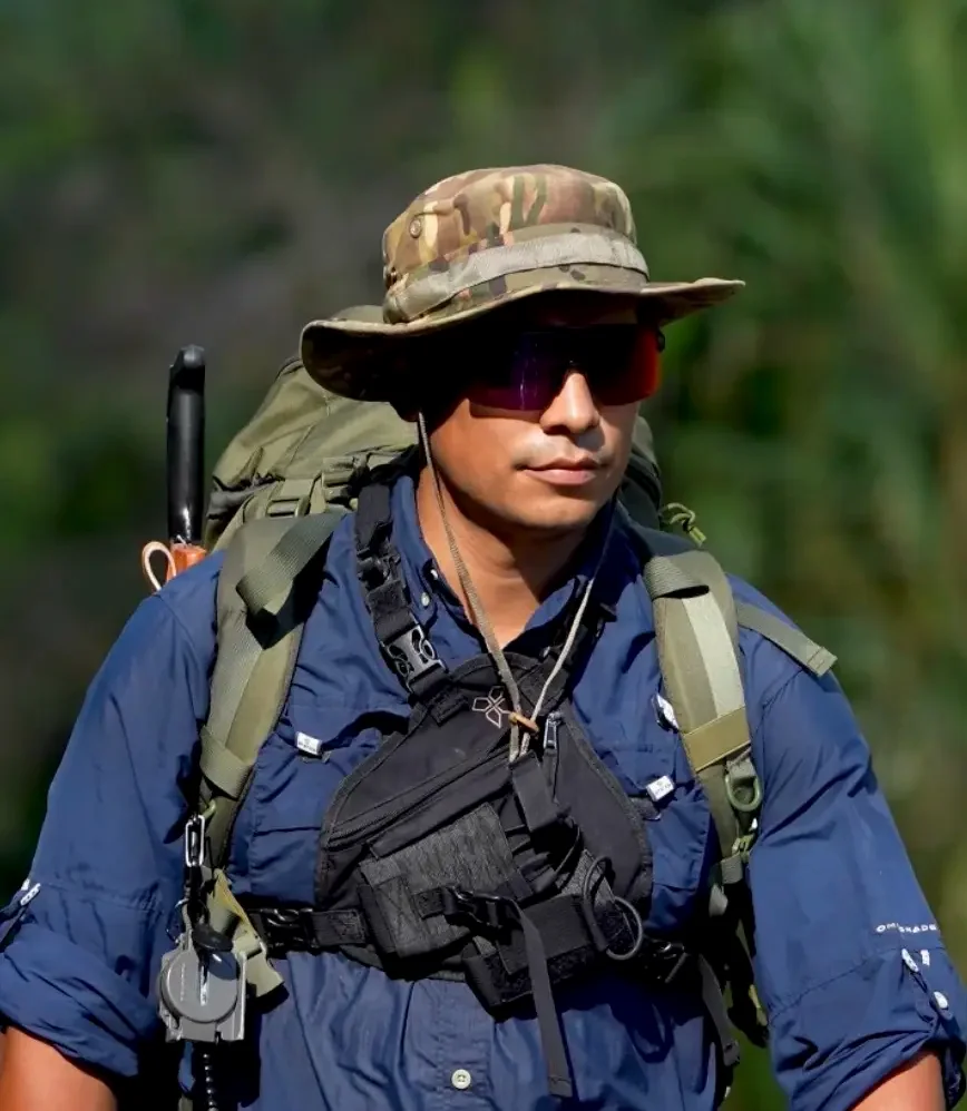
David Villanueva, wildlife guide and field operator, Osa Peninsula

David Villanueva

Wildlife guide & field operator · Osa Peninsula
Wilderness First Responder · Search & rescue

My field verdict

The area I would choose is not the one with the most wildlife

Six names, and every operator tells you something slightly different. So here is how I actually think about it after years of guiding and running expeditions here. I will start with my answer, because it is the one that surprises people most.

Where I would go myself

San Pedrillo and Los Planes

A waterfall in primary rainforest in the San Pedrillo area, Osa Peninsula
Waterfall, San Pedrillo area

If I had to choose one area, this is it — and the cost comes first: you will see less wildlife here than at Sirena. I would rather tell you now than have you find out on the trail.

What you get instead is more flora and fauna in total, in a forest that is taller and far more layered. There are simply more places for an animal to be, and most of them are above your head or out of sight. Nobody ever farmed this ground because it was never friendly to humans, and that is exactly why the old-growth forest survived here and not at Sirena. The terrain is irregular. Fewer people come.

Worth being clear about: most travellers visit San Pedrillo the traditional way — a day hike of about four kilometres, much like Sirena. That is a perfectly good introduction to primary rainforest. What we specialise in is going past that point, where the waterfalls, the river crossings and the giant trees are.

And here is the part that surprises people

Sirena is better for wildlife. I still don't pick it first.

Trail sign reading Estacion Sirena in the rainforest of Corcovado National Park
Trail sign, Sirena sector

None of the above means Sirena is second-rate. It is objectively the best place in this park to see animals, which is why it is in almost every itinerary we run. It is a young forest with heavy fruit production, sitting between two rivers and the ocean. Those three bodies of water act as biological barriers and concentrate wildlife between them, and the animals here are more used to people.

What I want to correct is the expectation about distance. On paper the trail network is around twenty kilometres. In practice you cover about eight. On a day trip my watch reads four. On an overnight, roughly ten across the two days. Going further makes no sense here, and I would be suspicious of anyone promising it.

That is not a limitation, it is the method. We walk slowly toward the convergence zones where the odds are better, and we stop constantly. When the trail network is not long enough to make distance the point, observation becomes the point. It is the right choice for wildlife photography and for understanding how the ecosystem fits together.

Measured on my own watch, across the tours we run

Day trip
4 kmSlow pace, constant stops
Overnight, 2 days
~10 kmMore hours, not more distance
Realistically coverable
~8 kmOf a network listed at ~20
And the honest part

Why La Leona and Los Patos are not where I would send you

La Leona to Sirena is a flat walk along the beach through secondary forest, essentially all of it. To be blunt, it resembles what you can already walk between Drake Bay and San Josecito on trails that are not even inside the park. For me it lacks the things that make this place worth the journey: primary forest, waterfalls, changing ecosystems, the feeling of being deep inside the jungle. La Leona and Sirena are close cousins — the difference is that Sirena offers more ecosystems, and therefore better chances of seeing something.

Los Patos is different. It is not that I dislike it — it is a good hike, though only at certain times of year because of the Rincón river. But here is the part most visitors never hear. That trail exists because people cut it. Sirena was once a small town with families living in it, and to reach the older settlements in the east of the peninsula — Rincón, La Palma, Puerto Jiménez — they had to walk out, either via Los Patos or via La Leona and Carate.

It is a human corridor between towns, not a wilderness trail.

That history is genuinely interesting, and it is also the reason you will not find the same primary forest there that you find at San Pedrillo or Los Planes. Being inland the whole way, it feels repetitive to me.

Both are still legitimate ways into the park, and plenty of people enjoy them. They are simply not my favourites, and you asked what I would pick.

Getting there

You cannot reach Corcovado in a day from San Jose

There is no road into this park and no direct route from the capital. Whatever you have read elsewhere, the trip works the same way for everyone: you travel to one of four towns on or near the Osa Peninsula, you sleep there at least one night, and you enter the park from that base the following morning.

That is the real cost of Corcovado, and it is not money. It is comfort and time. Other parks in Costa Rica will show you rainforest from a walkway an hour from your hotel. This one asks you to come to the last frontier of tourism in the country and give it two days minimum. What you get back is the difference between looking at a jungle and being inside one.

What follows is how to choose which base to travel to. If you already know where you are heading and just need the route itself — roads, timings and maps out of San Jose — we keep that in a separate guide: how to get to Corcovado, step by step.

Before anything else: you need a permit Entry is capped and you cannot walk in alone — a certified guide is required. The daily limit has been revised repeatedly in recent years as the park balances conservation against the needs of local communities, so any figure published online may already be out of date. Book through an operator or check with SINAC directly, and do it early: permits for the busiest sector regularly sell out months ahead.
START SLEEP HERE REACHES San Jose CAPITAL Drake Bay FLIGHT · OR BOAT VIA SIERPE San Pedrillo · Sirena Los Planes · corridors Puerto Jimenez FLIGHT OR ROAD La Leona · Sirena Los Patos Sierpe ROAD, THEN BOAT San Pedrillo only (also gateway to Drake Bay) Uvita ROAD, THEN LONG BOAT San Pedrillo only (day visits, standard trails) Highlighted route = the only hub that reaches the northern primary-forest sectors

Where you sleep decides which Corcovado you get to see.

The four access hubs

Drake Bay

Northwest Osa · The wild option

What it is
Effectively an extension of the park. Most of its territory sits inside the Golfo Dulce Forest Reserve, a protected area created shortly after Corcovado itself, and parts of it are wilder and less disturbed than sections of the national park.
Why it feels different
Elsewhere, nature surrounds the town. Here the town sits inside the nature. It is small, a little like a pirate cove, with virgin beaches and easy access to the Sierpe mangroves and Cano Island. You are immersed before you ever enter the park.
The catch
It is the hardest of the four to reach, and that is exactly why it stays the way it is.
By airLocal flights from San Jose to the Drake airstrip, roughly 45 minutes, around three departures a day.
Via SierpeBus or shuttle to Sierpe, then a one-hour boat through the mangroves. Buses run with Tracopa. Boats leave at 11:30 and 16:00, same fare either way — be at the Sierpe dock about twenty minutes early to check in with whoever is running the transfer that day. If you want the San Jose to Sierpe to Drake Bay leg broken down step by step, Gecko Routes has a thorough guide to that journey.
DrivingDrive to Sierpe and take the same boat, or continue by 4x4 all the way in. The overland route can involve river crossings unless you know the road that uses the bridge.
Something most guides never mention The two boats run on opposite principles. The morning departure is open competition — operators compete for passengers. The afternoon departure is communal: a different local boatman takes it each day, in turn, so the income is shared evenly among the captains rather than going to whoever shouts loudest. Same crossing, same price, two completely different economies.

Puerto Jimenez

Eastern Osa · The practical option

What it is
The largest town on the Osa Peninsula and the one with real infrastructure: banks, paved roads, a wide range of places to eat and sleep. It sits on the Golfo Dulce, close to the park but not as close as Drake Bay.
The trade-off
If Drake Bay is nature-centred, Puerto Jimenez is human-centred. That is a genuine advantage if you want services, a cash machine and a shorter list of logistical surprises.
Which sectors
It is the natural base for La Leona and Sirena, and the easiest starting point for Los Patos. It does not reach the northern primary-forest sectors.
By airDomestic flights from San Jose land at the town airport.
By roadReachable overland, and the drive is long. Paved roads in town make it easier to move around once you arrive.

Sierpe

River town · The connector

What it is
The smallest of the four and the one with the least tourism infrastructure, but a growing destination because it links the coast to the peninsula. Best known for the Sierpe mangroves, among the largest in Central America.
Reaching the park
You can run to San Pedrillo directly by boat from here, and it makes a good combination: mangrove and rainforest in the same day.
The limitation
The same one Uvita has. So much of the day goes on the water that there is no time to push deeper than the standard station trails.
By roadDrive, bus or shuttle from the coastal highway.
OnwardOne-hour boat through the mangroves to Drake Bay at 11:30 or 16:00, same fare, or a direct boat to San Pedrillo. Arrive at the dock about twenty minutes before departure.

Uvita

Coastal · The convenient option

What it is
The biggest and most developed of the four towns, with the widest choice of hotels and rentals. It is not on the Osa Peninsula, and that distance is the whole story.
Reaching the park
From Uvita you can realistically reach only San Pedrillo, and the boat ride is long. Every tour from here follows the standard station trails, because by the time you arrive there is no time left to go further in.
Straight answer
If you are already staying in Uvita and want to see Corcovado, this is your route and it is worth doing. But if the park is the reason you came to Costa Rica, sleep on the peninsula instead.
By roadOn the coastal highway, straightforward to reach and to drive from.
To the parkLong boat transfer to San Pedrillo. Expect most of your day on the water.
David Villanueva, wildlife guide and field operator, Osa Peninsula

David Villanueva

Wildlife guide & field operator · Drake Bay resident

Where I would sleep

Drake Bay, and it is not a close call

Rainbow over a forested beach at Drake Bay, Osa Peninsula
Drake Bay

You crossed an ocean and took at least one flight to get here. You did not do that to see a version of the tropics you could have found somewhere easier. You came because you wanted something genuinely different from what you are used to — and Drake Bay is where that starts before you even reach the park.

It is the last tourism frontier in this country, effectively on the doorstep of Corcovado. Arriving here already feels like entering the jungle. That is not marketing language; it is the practical result of a village of a thousand people sitting inside a protected forest instead of beside one.

Everywhere else, nature surrounds the town. Here the town sits inside the nature.

What else you can reach from here

Cano Island

The best diving and snorkelling within reach of mainland Costa Rica. Most visitors who come for the park never realise it is a short boat ride away.

The Sierpe mangroves

One of the largest mangrove forests in the country, and the most underrated wildlife trip in the region. More on why below.

The biological corridor

The protected forest bordering Corcovado. Fewer restrictions than inside the park, which means more freedom to explore and a stronger sense of adventure.

Why the mangrove is better for wildlife than people expect

Here is something worth understanding before you plan your days. In the tropics, most wildlife observation happens along rivers, not deep in the forest interior. River edges are gallery forest: the canopy opens, light reaches the lower layers, and that light produces the flowering and fruiting that animals come to feed on. Add water itself, which everything needs, and you get concentration.

That is why the Sierpe mangrove is one of the strongest places for wildlife watching anywhere on this continent — and in the tropical Americas, that is saying something. It is usually sold as a scenic boat ride. It is far more than that, and you can reach it from Drake Bay.

The town itself, honestly

What you will find

  • Local and international food
  • Free public trails to virgin beaches — you can walk to around fifteen of them on your own
  • Waterfalls close to the village
  • Bioluminescence at night, and some of the best Pacific sunsets in the country
  • Wildlife on the hotel grounds, not only in the park
  • Somewhere to sleep at every budget, from about fifteen dollars a night to a thousand

What you will not

  • Banks
  • Cash machines — bring what you need before you arrive
  • The larger infrastructure of a proper town
  • Paved convenience of any kind

One last thing, and it matters more than the hotels

Drake Bay lives entirely on nature tourism. Not tourism in general — nature tourism. The consequence is that this village holds the highest concentration of guides on the Osa Peninsula. People here did not become guides because there was a job going. They became naturalists because this is where the wildlife is, and then built a living around it. It is also why we run everything we do out of Drake Bay.

When you are choosing where to sleep, you are also choosing the pool of people who will walk you into the forest. That is the part of the decision most travellers never think about, and it is the one that changes what you actually see.

When to go

Every month works except one

Corcovado is open and worth visiting almost all year. The seasons do not decide whether you come — they decide how hard the walking is, how many people are on the trail beside you and what you are likely to see. The one exception is October, and that is not a preference, it is an operational fact.

SeasonThe forestThe trailWho else is there
DryLate Dec – end MarWater sources shrink, so animals concentrate around the ones that remain. The calendar says the dry season runs to mid-April. It does not: April is already raining.Firm underfoot, river crossings shallow and safe. Trail shoes are enough.Peak season. Christmas, Easter and the school holidays fill up months ahead.
The turnLate Apr – MayThe rains arrive and the forest answers. Breeding season for many species, so more movement and far more sound than at any other time.Some mud, nothing difficult. Boots recommended.The sweet spot. Noticeably fewer people, and lodges drop their rates.
GreenJun – NovThe jungle at full volume. Frogs, fungi, flowering, and humpback whales offshore from mid-July.Muddy. Rain arrives in heavy bursts of up to two hours, not all-day grey. We keep walking through it.Quiet, apart from a July bump.
Closed seasonOctoberThe wettest weeks of the year on this coast.Rivers rise fast and trails become genuinely unsafe.Nobody. The stations shut.
Do not plan your trip around October

Sirena and San Pedrillo normally close for three to four weeks, and we do not run tours at all that month. It is the only month of the year we stop.

You will find operators promoting October anyway, sometimes on the argument that it is a strong period for big-cat sightings. Make your own call, but understand what you are buying: swollen rivers, closed stations and a real chance the trip you paid for cannot run.

The timing that matters more than the month

Whichever season you choose, the hour beats the month. Day visitors fill the main loops between roughly nine in the morning and two in the afternoon — which is also the part of the day when the forest is quietest. Dawn and dusk are when it wakes up. That is the single strongest argument for staying the night rather than coming in and out on a boat.

Planning around a specific month?

We keep a full month-by-month breakdown of rainfall, prices and trail conditions. For what the animals are doing in each month, see the wildlife calendar further down this page.

Best time to visit, month by month

The wildlife

Nobody finds animals here by luck

Most people arrive with a picture in their head borrowed from somewhere else — open ground, long sightlines, large animals standing in the middle distance. That is a savannah. This is a rainforest, and it works on the opposite principle. Life here is stacked in layers from the leaf litter to the emergent crowns, and almost all of it is hidden, small, or above your head.

So the honest answer to what will I see begins with a different question: how does anyone find anything in here at all?

The forest tells you where to look. You have to know the language.

I tell travellers that my job is Sherlock Holmes and theirs is Watson. We are not walking around hoping. We are reading clues, and almost all of them arrive as sound. Here are three we work with constantly.

What we hear

A spider monkey giving a particular call

Monkeys see the forest floor better than we do, and they announce what they find there. The call itself tells us something is moving below them.

→ Possible puma nearby

What we hear

A toucan calling to mate, and which tree it is in

The bird matters less than the tree. If that species is fruiting, the fruit is falling, and something is underneath it collecting what lands.

→ Toucan, or peccaries digging below

What we hear

Three ant-following birds calling at once

A grey-headed tanager, a chestnut-backed antbird and a riverside wren or woodcreeper together is not a coincidence. Those species follow army ants, whose colonies can run to hundreds of thousands.

→ Army ant swarm, anteater, tarantulas and scorpions fleeing it

None of that is on a sign or a map. It is the reason a certified guide is required here, and the reason the same trail produces completely different days depending on who is walking it with you. It is also what our wildlife expeditions are built around.

The single best thing you can do: change ecosystems

The Osa Peninsula is a mosaic of microclimates, and each one holds a different cast. If wildlife is your reason for coming — and especially if you photograph it — the highest-return decision you can make is not more hours on one trail. It is more ecosystems across your trip.

Where What it is best for Realistic odds
Sirena The greatest diversity of mammals in the park: tapir, coati, both peccary species — collared and white-lipped — collared anteater, crocodile, caiman, snakes. In the right season the river mouth holds bull sharks and crocodiles at once, with tapirs crossing and monkeys feeding above. Most reliable
San Pedrillo & the north Tall primary forest. Harder to read, but this is cat country: over the last three years, roughly nine in ten of our puma sightings happened here. River otters too. Fewer, better
Sierpe mangroves Gallery forest along water — boat-billed heron, egrets, other herons, boa, sloth, crocodile, caiman, three monkey species. Consistently underrated for how much moves here. Very reliable
Cano Island & open water The marine half of this region, which most visitors forget Corcovado also protects: dolphins, whales in season, turtles, rays, sharks. Seabirds including brown and blue-footed booby, frigatebirds, pelicans. Seasonal but strong
Drake Bay, outside the park The best frogs in the region, in primary forest beside a river: red-eyed tree frog, poison dart frogs, glass frogs. Vipers more likely here too. Humidity is higher than at Sirena, which is exactly why the night walks are better outside the park than inside it. Best at night
Jaguar, anywhere We find tracks. A guest saw one two years ago. That is the whole record, and we are not going to dress it up for you. Effectively never

Why nothing here is as big as you expected

A small bracket fungus catching light on a mossy log in primary rainforest, Osa Peninsula
The scale most of this forest actually operates at

Competition makes things small

On a savannah there is comparatively little competition, so an animal can afford to be enormous. Think of early computers — a machine the size of a building, because nothing was pushing it to be smaller.

In a jungle, competition is relentless, and the pressure runs the other way. Every species has to fill its role in a smaller, cheaper, more efficient body. So this forest is full of creatures that have been optimised rather than enlarged — and they are astonishing once you learn to see them.

The clearest example is walking above your head right now. The ground sloth that once lived in the Americas reached around six metres; you can still see a replica at the Natural History Museum in London. Its modern descendant is about sixty-six centimetres.

Ancient ground sloth
~6 mExtinct
Sloth in these trees today
~66 cmSame lineage, optimised

If you came expecting elephants and giraffes, this is not that trip. What is here instead is density: hermit crabs and land crabs, insects, arachnids and other arthropods, reptiles, amphibians, more than 450 bird species across the Osa Peninsula, and a long list of mammals. Look at every limb, every trunk, every patch of leaf litter. The reward is in noticing.

What we will and will not tell you

Nobody can promise you an animal. A guide can read the forest, work the hours when it is awake, and put you in the right place — but if the forest gives no clue that day, no amount of experience produces one.

What we will say, having guided across Costa Rica and travelled other tropical regions, is this: going a whole day here and seeing nothing is close to impossible. The density is simply too high. The uncertainty is never about whether you will see wildlife. It is about which wildlife, and that is the part worth coming for.

Wildlife calendar

There is no bad wildlife month

Almost everything here is resident. Monkeys, macaws, toucans, tapirs, sloths and trogons live in this forest all year and do not leave. The season does not decide whether you see wildlife. It decides which wildlife, and how the day feels.

Come for tropical birds and the month barely matters. Come for whales and it matters a great deal.

Rain is a window, not a washout

Rain here is warm and it does not last: about thirty minutes in the dry season, up to two hours in the green months. We keep walking through it, because it rarely changes anything.

More usefully, we work with it. Animals go quiet while it pours, and the moment it stops the forest switches on — feeding, calling, moving. Being on the trail at the end of a downpour is one of the best places you can be, and the people who cancelled that morning are not there for it.

Pick a month

Dry · northern migration

January

Reliable light, calmer seas and low rainfall make January easy to plan.

    Best for
    Photography and the longest bird list
    Trade-off
    Peak season on the trails
    From the field
    Residents are here as always

    If you came for one thing in particular

    Whales15 July – November

    The southern humpbacks, and the bigger of the two seasons. A smaller northern run comes through roughly December to March.

    Longest bird listDecember – March

    Residents stay put all year; migrants from North America add to them, and the light is better for photographing any of it.

    Frogs and night walksMay – November

    Humidity drives amphibians, reptiles and fungi. The strongest night walks are outside the park, around Drake Bay.

    Sheer activityLate April – May

    The first rains bring breeding, calling and movement. More noise and more happening than any other point in the year.

    The big five of a night at Sirena

    Five mammals we expect to work for on an overnight, and usually find. Not the biggest animals on Earth — the ones this forest is built around.

    Baird's tapirLargest land mammal in tropical America
    SlothBoth two-toed and three-toed live here
    PeccaryCollared and white-lipped
    Northern tamanduaThe anteater of these forests
    White-nosed coatiUsually in noisy groups

    Alongside them: four monkey species — spider, howler, squirrel and capuchin — crocodiles and caimans, agoutis, red brocket deer, and snakes from boas to fer-de-lance. Caimans show themselves more readily in the green months. If wildlife is the reason you are coming rather than one item on a list, our wildlife-focused packages are built around crossing several ecosystems in one trip, which is what actually lengthens the list.

    About cats

    Pumas are rare and do not follow a season you can book around. In our own field records, sightings happened on roughly four out of every hundred tours, and most of those were in the San Pedrillo area. That is our internal observation, not a guarantee and not a park-wide statistic. Anyone selling you a big-cat season is guessing.

    This calendar is about the animals. For rainfall, crowds, trail conditions and the one month the park effectively shuts, see when to go further up this page.

    Tell us what you want to see, and we will tell you when to come

    There is no month that works for everything. Whales and the driest trails do not overlap. The longest bird list and the loudest forest are six months apart. Send us the two or three things that matter most to you and we will tell you which window fits — even if that window is not the one you had already booked flights for.

    Tickets and permits

    How to get tickets for Corcovado National Park

    There is no website where you buy a Corcovado ticket. No booking engine, no checkout, no instant confirmation. That is not an oversight anyone is about to fix — it is simply how the park works.

    Entry requires a certified guide whose name and licence number appear on the permit itself. Numbers are capped daily. And the reservation is handled by a person at a desk, checking availability in a spreadsheet.

    What booking a permit actually involves

    We are describing this in detail because almost nobody does, and because it explains why travellers get turned away at the ranger station. This is the real sequence for an overnight at Sirena.

    Emails, on average
    7To produce one prepaid permit
    Window to act
    24 hBefore the hold expires
    Parties involved
    3You, SINAC and ADI

    Every link in that chain can break, and the most common failure in this region is simple: the permit is lost somewhere along it. Sometimes that is the park's end. Often it is the operator's. Either way, the traveller finds out at the dock.

    Or you hand the whole chain to someone who does it every week

    We keep a dedicated team on this, with protocols and automations built around those seven emails and that 24-hour window, because the fastest way to lose a Corcovado trip is to lose a permit. So far we have not lost one. Tell us your dates and we take the paperwork from here — our Corcovado trips all include the permit.

    What this means when you choose an operator

    Read the reviews before you book, and read them specifically for this. Look for people saying their permits were in order, that nothing was left to the last minute, that the trip ran as booked. Plenty of operators in this area fail to secure tickets, and it is the single most common way a Corcovado trip collapses before it begins.

    Not every Costa Rican guide can take you in

    What a guide must hold to appear on a Corcovado permit

    • An ICT tourism guide licence
    • Written proof they know the trails and will follow SINAC regulations
    • Zero outstanding debt with the Costa Rican state
    • A letter from the tax authority confirming taxes paid on guiding
    • Public liability insurance
    • Occupational risk insurance
    • A Ministry of Health certificate of social insurance and compliance

    Any one of those lapses and the guide is off the list — not warned, off. An expired insurance certificate is enough. Which is why a guide being licensed in Costa Rica and being licensed for Corcovado are two different things.

    What the park itself costs

    The SINAC entrance fees are the smallest line in your budget. The boat, the guide, the meals at the station and the work of securing the permit are what make up the price of a Corcovado trip.

    WhoFeeNotes
    Non-resident adult$15Per person, per day, per sector
    Non-resident child, 2–12$5Proof of age may be requested
    Under 2FreeConsider the terrain before bringing an infant
    Camping, San Pedrillo$4Per night, on top of entry
    The cap keeps moving, and the region is fighting about it

    Daily visitor numbers were capped in 2022, raised in 2023, and the increase was struck down by the Constitutional Court in 2025. It has been revised more than once since. In June 2026, tour operators and guides blocked the road at Uvita demanding an answer from the government on the limits, arguing the restrictions were damaging local employment.

    Whatever number you read online may already be wrong. Reservations open up to six months out and the popular sectors fill early. Book as far ahead as you can.

    What you can and cannot bring

    Bags are checked at the station and the rules are enforced. People do get turned back.

    Bring

    • A refillable water bottle
    • Rubber boots or proper hiking shoes
    • Rain protection, whatever the season
    • Insect repellent and sun protection
    • Binoculars, if you own a pair
    • Passport or a copy, for the permit

    Leave behind

    • Food — not permitted into Sirena; meals go through the station
    • Single-use plastic of any kind
    • Cigarettes and lighters. No smoking anywhere
    • Pets
    • Drones, without written authorisation
    About swimming

    Older guides still recommend a dip in the Rio Claro. Current SINAC rules restrict bathing in rivers, beaches and lagoons inside the park, and conditions vary enormously from one spot to the next. The river mouth at Sirena, for instance, is used by bull sharks and crocodiles.

    Ask your guide before you get in the water anywhere. They know which places are safe on the day, and that judgement is not something a website can give you.

    Going with us

    Four ways we run Corcovado

    Everything above applies whoever you book with. This part is ours. We run four trips, they are genuinely different from each other, and the right one depends on what you decided while reading the rest of this page.

    Every price below is the full price. Park permit, certified guide, boat transport and meals are all in it. There is no separate entrance fee to pay at the ranger station and no tax added at the end.

    One day · 06:00–16:00

    Full Day Corcovado

    Sirena and San Pedrillo in a single sweep. Four monkey species, a hidden waterfall, and a first look at both halves of the park.

    Sectors
    Sirena + San Pedrillo
    Distance
    9–12 km
    Effort
    Medium

    $165per person, all in

    See the itinerary

    2 days · 1 night

    Sirena Overnight

    Sleep inside the park at Sirena. Tapir patrol at first light, macaws overhead, sunset on black sand. The gentlest way to get the hours that matter.

    Sectors
    Sirena
    Distance
    9–12 km
    Effort
    Easy · family friendly

    $390per person, all in

    See the itinerary

    2 days · 1 night

    Sirena & San Pedrillo Overnight

    Two stations, two forests. Sirena's regrowth for the wildlife, then San Pedrillo's old growth for the waterfalls and the silence.

    Sectors
    Sirena + San Pedrillo
    Sleeping
    Inside the park
    Effort
    Moderate

    $355per person, all in

    See the itinerary
    What we recommend most

    3 days · 2 nights

    Corcovado 3 Days, 2 Nights

    A night in each. Sirena's core zone for close observation, then San Pedrillo's back-trails: puma tracks, dawn frog chorus, waterfall canyons.

    Sectors
    Sirena + San Pedrillo
    Distance
    ~30 km
    Effort
    Moderate → challenging

    $615per person, all in

    See the itinerary

    Which one, in one line each

    Corcovado is one stop on a longer Costa Rica trip

    Full Day

    You want wildlife above all, at an easy pace, maybe with children

    Sirena Overnight

    You want both forests but only have one night

    Sirena & San Pedrillo Overnight

    Corcovado is why you came to Costa Rica

    3 Days, 2 Nights

    Why every serious quote lands in the same range

    Most of what you are paying for is not set by the operator. SINAC fixes the park entrance. ADI, the community association at Sirena, fixes meals and lodging inside the park. Boats cost what boats cost. Once those are covered there is very little room left to move, which is why honest quotes from different companies come out close together.

    So treat a noticeably cheaper figure as a question rather than a bargain. Ask what it excludes. Usually it is tax, or meals, or the park permit itself — and once you add those back you are at the same number, sometimes higher, having done the paperwork yourself.

    One thing to plan around

    Every tour begins with a compulsory briefing at our office in Drake Bay the day before, between midday and 6pm. It is where we go through terrain, kit and what the park expects of you. It also means you need to be in Drake Bay the night before — which, as the rest of this guide argues, is where you want to be anyway.

    Still not sure which fits?

    Tell us how many days you have, how hard you want to walk and what you most want to see. We will tell you which of the four fits — and if the honest answer is none of them, we will tell you that too.

    Plan your expedition